Property Record
537 Route 9, Waretown, NJ 08758


NEARBY LISTINGS FOR SALE OR LEASE
Property Detail
537 Route 9
Lakewood-New Brunswick, NJ
Minor
21-00041-0000-00039-02
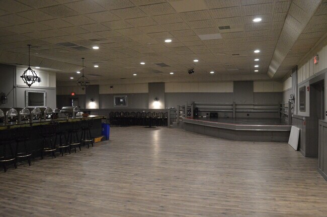
200X250 RESTAURANT
Commercialnec
Ocean
X
New Jersey
34029C0412F
39.2
2024
1.15 AC
2025
Ocean County
733002
Northern New Jersey
10,992 SF
DEMOGRAPHICS near 537 Route 9
1 Mile
3 Mile
5 Mile
2024 Total Population
3,120
22,295
56,433
2029 Population
3,410
24,061
60,360
Pop Growth 2024-2029
+ 9.29%
+ 7.92%
+ 6.96%
Average Age
44
44
43
2024 Total Households
1,305
9,132
21,892
HH Growth 2024-2029
+ 8.66%
+ 7.50%
+ 6.57%
Median Household Inc
$93,443
$86,907
$87,216
Avg Household Size
2.40
2.40
2.50
2024 Avg HH Vehicles
2.00
2.00
2.00
Median Home Value
$327,551
$347,767
$327,750
Median Year Built
1980
1982
1984
Nearby Places
Map Layers
Map Styles
 Street
 Aerial
- Restaurants
- Banks
- Shops
- Fitness
- Groceries
SALE & LEASE HISTORY
LISTING DATE
SALE/LEASE

Sep 25, 2016
For Lease
Sep 23, 2016
For Sale
Mar 31, 2017
For Sale
Mar 23, 2023
For Sale
Nearby Properties
Address
Land Use
TOTAL SIZE
Lot Size
Zoning
Address
Land Use
TOTAL SIZE
Lot Size
Zoning
139.60 AC
M6
Address
Land Use
TOTAL SIZE
Lot Size
Zoning
85.65 AC
R40
Address
Land Use
TOTAL SIZE
Lot Size
Zoning
528.70 AC
M6
Address
Land Use
TOTAL SIZE
Lot Size
Zoning
15.27 AC
C-2
Address
Land Use
TOTAL SIZE
Lot Size
Zoning
46.40 AC
ML-4
Address
Land Use
TOTAL SIZE
Lot Size
Zoning
9,617 SF
14.28 AC
WTB1
Address
Land Use
TOTAL SIZE
Lot Size
Zoning
85.65 AC
R40
Address
Land Use
TOTAL SIZE
Lot Size
Zoning
2.76 AC
TC
Address
Land Use
TOTAL SIZE
Lot Size
Zoning
15.12 AC
R-2
Address
Land Use
TOTAL SIZE
Lot Size
Zoning
9.32 AC
TCO+
Address
Land Use
TOTAL SIZE
Lot Size
Zoning
6,600 SF
10.67 AC
PRD
Address
Land Use
TOTAL SIZE
Lot Size
Zoning
11.24 AC
R-2
Address
Land Use
TOTAL SIZE
Lot Size
Zoning
9.65 AC
R-75
Address
Land Use
TOTAL SIZE
Lot Size
Zoning
37.70 AC
TCMX
Address
Land Use
TOTAL SIZE
Lot Size
Zoning
23.70 AC
BCWD
Address
Land Use
TOTAL SIZE
Lot Size
Zoning
89.90 AC
R-2
Address
Land Use
TOTAL SIZE
Lot Size
Zoning
56.23 AC
BC
Address
Land Use
TOTAL SIZE
Lot Size
Zoning
2,557 SF
633.96 AC
Address
Land Use
TOTAL SIZE
Lot Size
Zoning
8.76 AC
C150
Address
Land Use
TOTAL SIZE
Lot Size
Zoning
18.15 AC
TCMX
Address
Land Use
TOTAL SIZE
Lot Size
Zoning
4,230 SF
10.65 AC
CPHD
Address
Land Use
TOTAL SIZE
Lot Size
Zoning
40 AC
TCEC
Address
Land Use
TOTAL SIZE
Lot Size
Zoning
4.85 AC
CPHD
Address
Land Use
TOTAL SIZE
Lot Size
Zoning
18,980 SF
4.19 AC
TCEC
Address
Land Use
TOTAL SIZE
Lot Size
Zoning
3.34 AC
C-1
Address
Land Use
TOTAL SIZE
Lot Size
Zoning
6.25 AC
C100
Address
Land Use
TOTAL SIZE
Lot Size
Zoning
16,992 SF
31.88 AC
FO
Address
Land Use
TOTAL SIZE
Lot Size
Zoning
13,092 SF
1.79 AC
C-2
Address
Land Use
TOTAL SIZE
Lot Size
Zoning
6,976 SF
1.29 AC
C150
Address
Land Use
TOTAL SIZE
Lot Size
Zoning
4.70 AC
ML5
The World's #1 Commercial Real Estate Marketplace
Connect with us
© 2026 CoStar Group
The information above has been obtained from sources believed reliable. While we do not doubt its accuracy we have not verified it and make no guarantee, warranty or representation about it. It is your responsibility to independently confirm its accuracy and completeness. Any projections, opinions, assumptions, or estimates used are for example only and do not represent the current or future performance of the property. The value of this transaction to you depends on tax and other factors which should be evaluated by your tax, financial, and legal advisors. You and your advisors should conduct a careful, independent investigation of the property to determine to your satisfaction the suitability of the property for your needs.